 打印
打印
线性混合像元分解及其在林业中的应用
编号
lyqk005978


中文标题
线性混合像元分解及其在林业中的应用
作者单位
北京林业大学省部共建森林培育与保护教育部重点实验室,北京 100083,北京林业大学省部共建森林培育与保护教育部重点实验室,北京 100083
期刊名称
世界林业研究
年份
2017
卷号
30
期号
5
栏目编号
1
栏目名称
专题论述
中文摘要
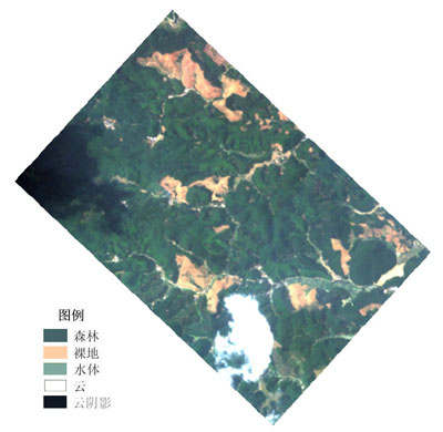
由于地表覆盖的复杂性,在遥感影像中存在混合像元现象。文中对混合像元分解模型进行梳理,并针对线性混合像元分解在林业中的应用做了分类总结。目前混合像元分解模型主要有线性、概率、几何光学、随机几何与模糊模型5种,不同模型所需参数与输出结果也存在一定差异。其中线性混合模型在林业中的应用最为广泛,主要有土地利用分类与变化监测、森林灾害监测、稀疏植被探测、城市植被丰度估算、不均匀冠层参数估算等方面。
基金项目
国家林业局项目“基于FORPLAN的森林多功能经营技术引进”(2015-4-31)。
英文标题
Linear Unmixing and Its Application in Forestry Sector
作者英文名
Chen Liping and Sun Yujun
单位英文名
The Key Laboratory for Sivilculture and Conservation of Ministry of Education,Beijing Forestry University,Beijing 100083,China and The Key Laboratory for Sivilculture and Conservation of Ministry of Education,Beijing Forestry University,Beijing 100083,China
英文摘要
Due to the complexity of the land cover, there are pixel mixture in the remote sensing image. This paper reviewed the pixel unmixing models, and classified and concluded its application in forestry. Currently, the pixel unmixing model mainly contains the linear model, probability model, geometrical optics model, stochastic geometry and fuzzy model. These models have different parameters and outputs. The linear mixed model is most widely used in forestry, mainly in land use classification and monitoring, forest disaster monitoring, detection of sparse vegetation, estimation of urban vegetation abundance and estimation for uneven canopy physical parameters.
英文关键词
pixel unmixing;remote sensing image;forestry remote sensing
起始页码
39
截止页码
44
投稿时间
2017/2/17
分类号
S771.8
DOI
10.13348/j.cnki.sjlyyj.2017.0047.y
参考文献
[1] 李德仁,王长委,胡月明,等. 遥感技术估算森林生物量的研究进展[J]. 武汉大学学报(信息科学版),2012,37(6):631-635.
[2] 汤旭光,刘殿伟,王宗明,等. 森林地上生物量遥感估算研究进展[J]. 生态学杂志,2012,31(5):1311-1318.
[3] 张志,田昕,陈尔学,等. 森林地上生物量估测方法研究综述[J]. 北京林业大学学报,2011,33(5):144-150.
[4] BEAUDOIN A, Le TOAN T, GOZE S, et al. Retrieval of forest biomass from SAR data[J]. International Journal of Remote Sensing, 1994, 15(14):2777-2796.
[5] GAVEAU D. Modelling the dynamics of ERS-1/2 coherence with increasing woody biomass over boreal forests[J]. International Journal of Remote Sensing, 2002, 23(18):3879-3885.
[6] LU D. Aboveground biomass estimation using Landsat TM data in the Brazilian Amazon[J]. International Journal of Remote Sensing, 2005, 26(12):2509-2525.
[7] 商珍珍. 基于多源遥感毛竹林信息提取及地上部分碳储量估算研究[D].杭州:浙江农林大学,2012.
[8] ICHOKU C, KARNIELI A. A review of mixture modeling techniques for sub-pixel land cover estimation[J]. Remote Sensing Reviews, 1996, 13(3):161-186.
[9] ADAMS J B, SMITH M O, JOHNSON P E. Spectral mixture modeling:a new analysis of rock and soil types at the Viking Lander 1 site[J]. Journal of Geophysical Research:Solid Earth, 1986, 91(B8):8098-8112.
[10] SMITH M O, USTIN S L, ADAMS J B, et al. Vegetation in deserts:I. a regional measure of abundance from multispectral images[J]. Remote sensing of Environment, 1990, 31(1):1-26.
[11] LI X, STRAHLER A H. Geometric-optical modeling of a conifer forest canopy[J].IEEE Transactions on Geoscience & Remote Sensing, 1985, GE-23(5):705-721.
[12] LI X, STRAHLER A H. Geometric-optical bidirectional reflectance modeling of a conifer forest canopy[J]. IEEE Transactions on Geoscience & Remote Sensing, 1986, 24(6):906-919.
[13] 吕长春,王忠武,钱少猛. 混合像元分解模型综述[J]. 遥感信息,2003(3):55-58.
[14] MARSH S E, SWITZER P, KOWALIK W S, et al. Resolving the percentage of component terrains within single resolution elements[J].Photogrammetric Engineering & Remote Sensing, 1980, 46(8):1079-1086.
[15] JASINSKI M F, EAGLESON P S. Structure of red-infrared scattergrams of semivegetated landscapes[J]. IEEE Transactions on Geoscience & Remote Sensing, 1989, 27(4):441-451.
[16] JASINSKI M F, EAGLESON P S. Estimation of subpixel vegetation cover using red-infrared scattergrams[J]. IEEE Transactions on Geoscience & Remote Sensing, 1990, 28(2):253-267.
[17] LU D, MORAN E, BATISTELLA M. Linear mixture model applied to Amazonian vegetation classification[J]. Remote Sensing of Environment, 2003, 87(4):456-469.
[18] XI Z, LU D, LIU L, et al. Detection of drought-induced hickory disturbances in western Lin An County, China,using multitemporal landsat imagery[J]. Remote Sensing, 2016, 8(4):345-362.
[19] 奚祯苑,刘丽娟,陆灯盛,等. 基于线性混合像元分解技术提取山核桃空间分布[J]. 林业科学,2015,51(10):43-52.
[20] 陈峰,邱全毅,熊永柱,等. 基于线性光谱模型的混合像元分解方法与比较[J]. 遥感信息,2010(4):22-28.
[21] LI L, LU D, KUANG W. Examining urban impervious surface distribution and its dynamic change in Hangzhou metropolis[J]. Remote Sensing, 2016, 8(3):265-285.
[22] 武红敢,常原飞,石木耀. 森林灾害的高分遥感辅助调查技术体系研究[J]. 林业资源管理,2014(5):43-50.
[23] VIKHAMAR D, SOLBERG R. Snow-cover mapping in forests by constrained linear spectral unmixing of MODIS data[J]. Remote Sensing of Environment, 2003, 88(3):309-323.
[24] VIKHAMAR D, SOLBERG R. A constrained spectral unmixing approach to snow-cover mapping in forests using MODIS data[J].IEEE International Geoscience and Remote Sensing Symposium, 2003(2):833-835.
[25] CHEN X, BAO A, ZHANG H, et al. A study on methods and accuracy assessment for extracting snow covered areas from MODIS images based on pixel unmixing:a case on the middle of the Tianshan Mountain[J]. Resources Science, 2010, 9(2):243-262.
[26] 王芳,杨武年,刘汉湖,等. 基于混合像元线性分解的5.12地震后汶川县由地质灾害导致的植被覆盖度变化研究[C].International Conference on Remote Sensing,2010.
[27] 许积层. 基于像元分解的5.12汶川震后植被覆盖监测[D]. 成都:成都理工大学,2013.
[28] 祝善友,陈亭,曹云,等. 基于线性光谱分解方法的森林选择性砍伐与再生监测研究:以巴西亚马逊森林为例[J]. 科学技术与工程,2015,15(20):78-83.
[29] PUREVDORJ T, TATEISHI R, ISHIYAMA T, et al. Relationships between percent vegetation cover and vegetation indices[J]. International Journal of Remote Sensing, 1998, 19(18):3519-3535.
[30] GUERSCHMAN J P, HILL M J, RENZULLO L J, et al. Estimating fractional cover of photosynthetic vegetation, non-photosynthetic vegetation and bare soil in the Australian tropical savanna region upscaling the EO-1 Hyperion and MODIS sensors[J]. Remote Sensing of Environment, 2009, 113(5):928-945.
[31] 张号,屈建军,张克存. 绿洲植被覆盖度遥感信息提取:以敦煌绿洲为例[J]. 中国沙漠,2015,35(2):493-498.
[32] 李晓松,高志海,李增元,等. 基于高光谱混合像元分解的干旱地区稀疏植被覆盖度估测[J]. 应用生态学报,2010,21(1):152-158.
[33] LI X, ZHANG X, ZHANG H Y, et al. Quantitative inversion of sparse vegetation coverage in desertification area[C].International Conference on Applied Science and Engineering Innovation. Atlantis Press, 2015:1713-1717.
[34] SMALL C. Estimation of urban vegetation abundance by spectral mixture analysis[J]. International Journal of Remote Sensing, 2001, 22(7):299-307.
[35] WENG Q, LU D, SCHUBRING J. Estimation of land surface temperature-vegetation abundance relationship for urban heat island studies[J]. Remote Sensing of Environment, 2004, 89(4):467-483.
[36] GRUNINGER J H, RATKOWSKI A J, HOKE M L. The sequential maximum angle convex cone (SMACC) endmember model[J]. Proc Spie, 2004, 5425:1-14.
[37] 陈绪志,赖格英,潘瑞鑫,等. 基于线性混合模型的丘陵山区植被丰度遥感信息提取研究:以江西梅江流域为例[J]. 江西科学,2012,30(4):473-479.
[38] 陈丽,张晓丽,焦志敏. 基于混合像元分解模型的森林叶面积指数反演[J]. 农业工程学报,2013,29(13):124-129.
[39] DU H, FAN W, ZHOU G, et al. Retrieval of canopy closure and LAI of moso bamboo forest using spectral mixture analysis based on real scenario simulation[J]. IEEE Transactions on Geoscience & Remote Sensing, 2011, 49(11):4328-4340.
[40] BASUKI T M, SKIDMORE A K, LAAKE P E V, et al. The potential of spectral mixture analysis to improve the estimation accuracy of tropical forest biomass[J]. Geocarto International, 2012, 27(4):329-345.
[41] 郭春蕾, 解潍嘉, 黄华国. 应用混合像元分解提取胡杨覆盖度信息[J]. 东北林业大学学报, 2014(11):82-87.
[42] 严恩萍,林辉,王广兴,等. 基于MODIS混合像元分解的湖南省森林碳密度反演[J]. 应用生态学报,2015,26(11):3433-3442.
[43] 陈玲,郝文乾,高德亮. 光学影像纹理信息在林业领域的最新应用进展[J]. 北京林业大学学报,2015,37(3):1-12.
PDF全文
浏览全文
-
相关记录
更多
- 森林扰动遥感影像检测方法研究进展 2022
- 基于Landsat-8遥感影像的扬州市城市公园夏季温湿效应 2023
- 广州市主城区绿地信息提取及其动态变化分析 2014
- 基于载人航天平台的林业遥感应用 2013
- 林业遥感云平台的系统结构与功能设计 2013
- 世界林业航天遥感进展 1993
相关图谱
相关动态


相关信息